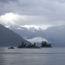
Von Donop Marine Provincial Park, provincial marine park in British Columbia, Canada
Ort: British Columbia
GPS Koordinaten: 50.17361,-124.95833
Neueste Aktualisierung: 25. November 2025 um 23:50
Desolation Sound Marine Provincial Park
20.4 km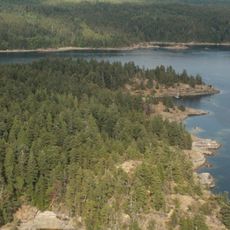
Copeland Islands Marine Provincial Park
19.9 km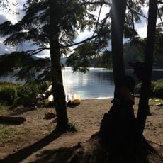
Main Lake Provincial Park
18.9 km
Smelt Bay Provincial Park
15.7 km
Roscoe Bay Provincial Park
13.3 km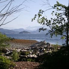
Rebecca Spit Marine Provincial Park
18 km
Mansons Landing Provincial Park
12 km
Malaspina Provincial Park
20.8 km
Teakerne Arm Provincial Park
8.8 km
Surge Narrows Provincial Park
15.2 km
Háthayim Marine Provincial Park
410 m
Walsh Cove Provincial Park
15.4 km
Read Island Provincial Park
13 km
Rendezvous Island South Provincial Park
11 km
East Redonda Island Ecological Reserve
20.4 km
Bullock Bluff
7.8 km
Marina Reef
16.1 km
Beach
12.2 km
Hague lake day use area
12.3 km
Yulia Beach
10.4 km
Works of Art
19.6 km
Shark Spit
11.1 km
Antonio Point
15.3 km
Aussichtspunkt
11.1 km
Easter Bluffs
11.1 km
Homewood Bluff
16.5 km
Desolation Bluffs
15.4 km
Wasserfall
20.1 kmBewertungen
Diesen Ort besucht? Tippe auf die Sterne, um ihn zu bewerten und deine Erfahrung oder Fotos mit der Community zu teilen! Jetzt ausprobieren! Sie können jederzeit kündigen.
Entdecke verborgene Schätze auf jedem Abenteuer!
Von charmanten kleinen Cafés bis zu versteckten Aussichtspunkten – entfliehe dem Touristentrubel und finde Orte, die wirklich zu dir passen. Unsere App macht's dir leicht: Sprachsuche, clevere Filter, optimierte Routen und echte Geheimtipps von Reisenden weltweit. Jetzt runterladen und das Abenteuer mobil erleben!

Ein neuer Ansatz für touristische Entdeckungen❞
— Le Figaro
Alle Orte, die eine Entdeckung wert sind❞
— France Info
Ein maßgeschneiderter Ausflug mit nur wenigen Klicks❞
— 20 Minutes