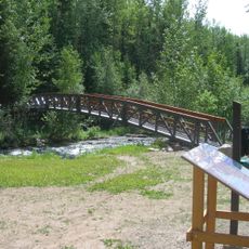
Long Island Conservancy, protected area in British Columbia, Canada
Ort: Regional District of Bulkley-Nechako
GPS Koordinaten: 54.88750,-126.13556
Neueste Aktualisierung: 22. November 2025 um 03:34
Driftwood Canyon Provincial Park
57.2 km
Cunningham Lake
61.7 km
Tyhee Lake Provincial Park
61.3 km
Babine Mountains Provincial Park
51.3 km
Rainbow Alley Provincial Park
59.3 km
Babine Lake Marine Provincial Park
50 km
Red Bluff Provincial Park
4.7 km
Rubyrock Lake Provincial Park
55.4 km
Mount Blanchet Provincial Park
47.3 km
Ethel F. Wilson Memorial Provincial Park
59.7 km
Topley Landing Provincial Park
7.7 km
Trembleur Lake Provincial Park
58.1 km
Takla Lake Marine Provincial Park
40.8 km
Burnt Cabin Bog Ecological Reserve
52.2 km
Takla Lake Ecological Reserve
53.1 km
Bear Island Conservancy
9 km
North Spit Conservancy
49.9 km
Sand Point Conservancy
22.1 km
Sanctuary Bay Conservancy
19.2 km
Wilkinson-Wright Bay Conservancy
15 km
Port Arthur Conservancy
16.2 km
Torkelsen Lake Ecological Reserve
42.8 km
Old Man Lake Provincial Park
55.7 km
Reef Bluff
46.5 km
Willow Grove Golf & Country Club
58.3 km
Houston Golf & Country Club
61.3 km
Turm, Aussichtsturm, Aussichtspunkt
41.4 km
Turm, Aussichtsturm, Aussichtspunkt
18.7 kmBewertungen
Diesen Ort besucht? Tippe auf die Sterne, um ihn zu bewerten und deine Erfahrung oder Fotos mit der Community zu teilen! Jetzt ausprobieren! Sie können jederzeit kündigen.
Entdecke verborgene Schätze auf jedem Abenteuer!
Von charmanten kleinen Cafés bis zu versteckten Aussichtspunkten – entfliehe dem Touristentrubel und finde Orte, die wirklich zu dir passen. Unsere App macht's dir leicht: Sprachsuche, clevere Filter, optimierte Routen und echte Geheimtipps von Reisenden weltweit. Jetzt runterladen und das Abenteuer mobil erleben!

Ein neuer Ansatz für touristische Entdeckungen❞
— Le Figaro
Alle Orte, die eine Entdeckung wert sind❞
— France Info
Ein maßgeschneiderter Ausflug mit nur wenigen Klicks❞
— 20 Minutes