
Broomhaugh and Riding Mill War Memorial, war memorial in Broomhaugh and Riding, Northumberland, UK
GPS Koordinaten: 54.94598,-1.97281
Neueste Aktualisierung: 16. November 2025 um 10:15
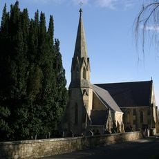
Church of St James
58 m
Methodist Chapel
426 m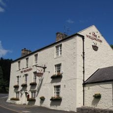
Wellington Inn
203 m
Stable End Yew Tree Cottage
412 m
Mrs Williams' Cottage
78 m
House Adjoining Methodist Chapel
419 m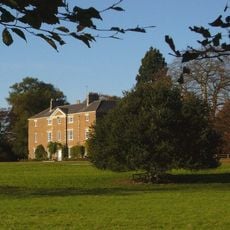
Styford Hall
880 m
Forecourt Walls And Piers To Manor House
610 m
Broomhaugh Farmhouse And Arch At South West Corner
493 m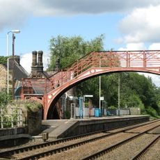
Footbridge at Riding Mill railway station
317 m
The Manor House And Wall Attached To Rear
603 m
Hollin Hill Terrace
335 m
Oaklands
196 m
Stable Block 30 Metres North-East Of Styford Hall
944 m
Boundary Stone 100 Metres South-East Of High Shilford Farmhouse
864 m
Road Bridge Over Railway
293 m
Boundary Stone On North Side Of Footpath 70 Metres East Of Whiteside Cottage
180 m
The Dower House East And The Dower House West
592 m
Range Of Farm Buildings On North Of Riding Farmhouse (Q.V.)
690 m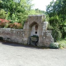
Drinking Fountain 60 Metres South-East Of Church Of St. James
68 m
Riding Farmhouse
684 m
Stationmaster's House At Riding Mill Station
315 m
3 and 4 Riding Cottages
504 m
Boundary Stone On East Of Wood 7 Metres South Of Drive To The Glebe
242 m
Hollin Hill Cottage
452 m
The Riding
548 m
1 and 2 Riding Cottages
492 m
Aussichtspunkt
601 mBewertungen
Diesen Ort besucht? Tippe auf die Sterne, um ihn zu bewerten und deine Erfahrung oder Fotos mit der Community zu teilen! Jetzt ausprobieren! Sie können jederzeit kündigen.
Entdecke verborgene Schätze auf jedem Abenteuer!
Von charmanten kleinen Cafés bis zu versteckten Aussichtspunkten – entfliehe dem Touristentrubel und finde Orte, die wirklich zu dir passen. Unsere App macht's dir leicht: Sprachsuche, clevere Filter, optimierte Routen und echte Geheimtipps von Reisenden weltweit. Jetzt runterladen und das Abenteuer mobil erleben!

Ein neuer Ansatz für touristische Entdeckungen❞
— Le Figaro
Alle Orte, die eine Entdeckung wert sind❞
— France Info
Ein maßgeschneiderter Ausflug mit nur wenigen Klicks❞
— 20 Minutes