Holmewood House School, school building, formerly house in Speldhurst, Kent, United Kingdom
Ort: Speldhurst
GPS Koordinaten: 51.12584,0.21663
Neueste Aktualisierung: 20. November 2025 um 22:56
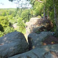
High Rocks
752 m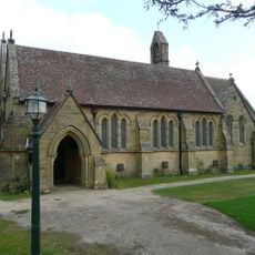
Church of All Saints
1.2 km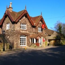
High Rocks Inn
700 m
Prehistoric rock shelters and a multivallate hillfort at High Rocks, 309m ESE of High Rocks Inn
1 km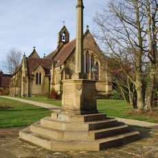
Langton Green War Memorial
1.1 km
Coldbath Farmhouse
1.1 km
Entrance Building To High Rocks Inn
734 m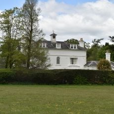
Langton House
1.2 km
Hollonds Farmhouse
1.1 km
Stables Approximately 10 Metres North East Of Hollonds Farmhouse
1.1 km
Forge Approximately 5 Metres North Of Forge House
1.1 km
Rusthall
1.1 km
Adam Cottage
1.1 km
Old Birchetts Including Front Area Railings
1.1 km
1 and 2, the Green
1 km
Pair Of Gate Piers And Gates At The Entrance To The Hollands
890 m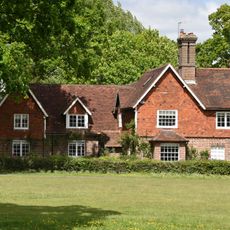
Firtree Cottage
1.2 km
Broom Farmhouse
636 m
Searles Stonewall
1.2 km
Penn Cottage
1.1 km
Greenholme Wheelwrights Cottage
1.1 km
Lampington Cottage
1.1 km
Little Oaklands Oaklands House Oaklands House And Little Oaklands Including Front Boundary Railings
664 m
Broomlands Including Retaining Wall To The Terrace To The South
812 m
The Old Cottage
1 km
The Hollands
1 km
Dornden Innerdown Middle House
959 m
High Rocks
982 mBewertungen
Diesen Ort besucht? Tippe auf die Sterne, um ihn zu bewerten und deine Erfahrung oder Fotos mit der Community zu teilen! Jetzt ausprobieren! Sie können jederzeit kündigen.
Entdecke verborgene Schätze auf jedem Abenteuer!
Von charmanten kleinen Cafés bis zu versteckten Aussichtspunkten – entfliehe dem Touristentrubel und finde Orte, die wirklich zu dir passen. Unsere App macht's dir leicht: Sprachsuche, clevere Filter, optimierte Routen und echte Geheimtipps von Reisenden weltweit. Jetzt runterladen und das Abenteuer mobil erleben!

Ein neuer Ansatz für touristische Entdeckungen❞
— Le Figaro
Alle Orte, die eine Entdeckung wert sind❞
— France Info
Ein maßgeschneiderter Ausflug mit nur wenigen Klicks❞
— 20 Minutes