
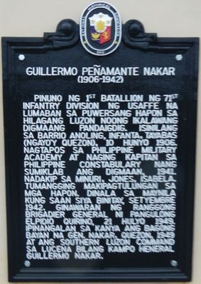
Guillermo Peñamante Nakar historical marker
Guillermo Peñamante Nakar historical marker, NHCP historical marker for Guillermo Nakar
Ort: General Nakar
Gründung: 10. Juni 2012
Schöpfer: National Historical Commission of the Philippines
Adresse: Sitio Bungko, Brgy. Anoling
GPS Koordinaten: 14.75686,121.62100
Neueste Aktualisierung: 17. April 2025 um 05:05
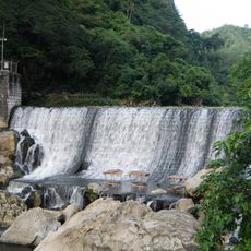
Wawa Dam
46.3 km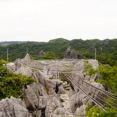
Masungi Georeserve
34.8 km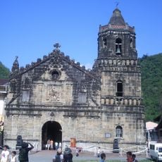
Paete Church
46.2 km
Pamitinan Protected Landscape
46.7 km
Pamitinan Cave
46.5 km
Upper Marikina River Basin Protected Landscape
44.8 km
Morong Church
46.1 km
Siniloan Church
41.8 km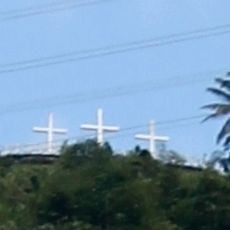
Three Crosses of Paete
45.8 km
Mabitac Church
42.3 km
Lokal ng Padilla
49.2 km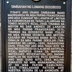
Church of Old Bosoboso historical marker
43.2 km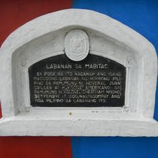
Battle of Mabitac historical marker
42.1 km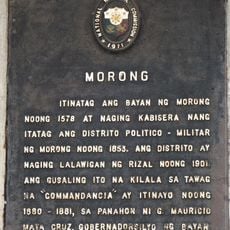
Morong historical marker
49.3 km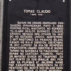
Tomas Claudio historical marker
49.4 km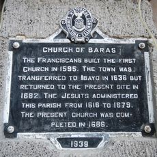
Church of Baras historical marker
46.1 km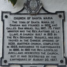
Church of Santa Maria historical marker
38.3 km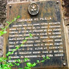
Pililla Church historical marker
45.8 km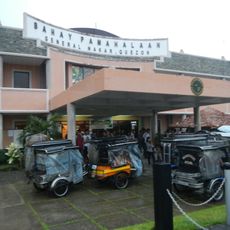
General Nakar Municipal Hall
26 m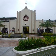
Infanta Cathedral
3.3 km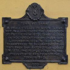
Town of Tanay historical marker
46.3 km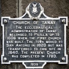
Church of Tanay historical marker
46.2 km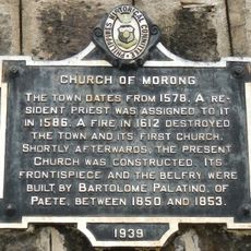
Church of Morong historical marker
49.3 km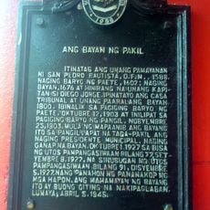
The Town of Pakil historical marker
44.6 km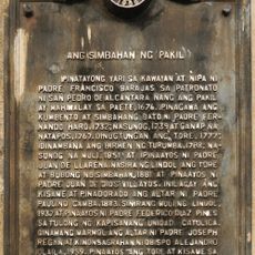
The Church of Pakil historical marker
44.6 km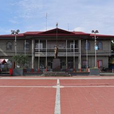
Commandancia
49.3 km
Pakil Municipal Hall
44.6 km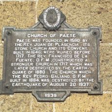
Church of Paete historical marker
46.2 kmDiesen Ort besucht? Tippe auf die Sterne, um ihn zu bewerten und deine Erfahrung oder Fotos mit der Community zu teilen! Jetzt ausprobieren! Sie können jederzeit kündigen.
Entdecke verborgene Schätze auf jedem Abenteuer!
Von charmanten kleinen Cafés bis zu versteckten Aussichtspunkten – entfliehe dem Touristentrubel und finde Orte, die wirklich zu dir passen. Unsere App macht's dir leicht: Sprachsuche, clevere Filter, optimierte Routen und echte Geheimtipps von Reisenden weltweit. Jetzt runterladen und das Abenteuer mobil erleben!

Ein neuer Ansatz für touristische Entdeckungen❞
— Le Figaro
Alle Orte, die eine Entdeckung wert sind❞
— France Info
Ein maßgeschneiderter Ausflug mit nur wenigen Klicks❞
— 20 Minutes