
A cairn and a rubble bank in Scale Knoll Allotment, 510m WSW of Haythwaite, Barningham Moor
A cairn and a rubble bank in Scale Knoll Allotment, 510m WSW of Haythwaite, Barningham Moor, archäologische Stätte im Vereinigten Königreich
Ort: Barningham
GPS Koordinaten: 54.47510,-1.91999
Neueste Aktualisierung: 28. Oktober 2025 um 06:14
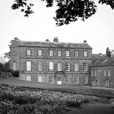
Barningham Park
3.6 km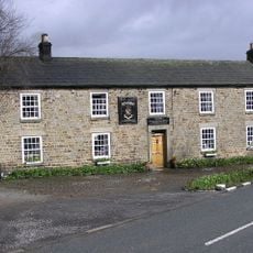
Milbank Arms
3.6 km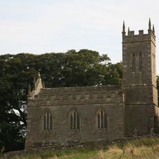
Church of St Mary
4 km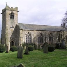
Church of St. Michael
3.6 km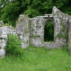
Ruins of Old Church of St Mary
4.1 km
Monument On Adam Hill, South East Of Barningham Park
3.8 km
Carved rock and Romano-British settlement known as Greystone, 250m south of Moorcock Farm, Barningham Moor
1.6 km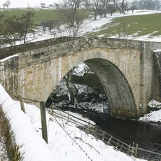
Rutherford Bridge
3.8 km
Cairn on the summit of Arndale Hill, Hope Moor
3.6 km
Cairn near the summit of a low ridge, 850m south west of Cocker Stake Nook, Hope Moor
2.8 km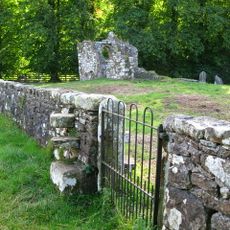
Churchyard Wall Around Old Church Of St Mary
4.1 km
Carved rock 380m ENE of Bragg House, Barningham Moor
2.5 km
A carved rock and boulder walling, near the south wall of Scale Knoll Allotment, 500m north east of Black Hill Gate
501 m
Carved rocks, cairnfield and rubble banks on the terrace south of Scale Knoll Allotment, immediately east of Black Hill Gate, Ba
674 m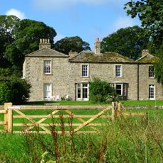
Brignall Grange
3.9 km
Cairn, 650m SSE of Bragg House, Barningham Moor
2.1 km
Prehistoric carved rocks and associated remains including cairns and a field system 800m south of Haythwaite, Barningham Moor
746 m
Carved rock and cairn in Rowley Intake, 410m south east of Cowclose House, Barningham Moor
1.5 km
Cairn south of Cross Gill, 645m south east of Black Hill Gate, Barningham Moor
1.2 km
Cairn, 625m SSE of Bragg House, Barningham Moor
2.1 km
Cairnfield and associated remains, 250m south east of Bragg House, Barningham Moor
2.4 km
A carved rock within a large enclosure, 800m north east of Badger Way Stoop, Barningham Moor
1.7 km
Cairn, 545m ESE of Bragg House, Barningham Moor
2.5 km
A carved rock between The Stang Forest boundary wall and Woodclose Gill, 750m south east of Far East Hope, Barningham Moor
780 m
Prehistoric settlement and associated remains including carved rocks and a stone circle 400m north west of How Tallon Cairn, Bar
1.2 km
Cairnfield on a small knoll at Badger Way Stoop, Barningham Moor
1.5 km
Carved rock north of Washbeck Green, 570m south of Haythwaite, Barningham Moor
639 m
Carved rock and prehistoric enclosure on west side of Scale Knoll Gill, 410m south west of Haythwaite, Barningham Moor
200 mBewertungen
Diesen Ort besucht? Tippe auf die Sterne, um ihn zu bewerten und deine Erfahrung oder Fotos mit der Community zu teilen! Jetzt ausprobieren! Sie können jederzeit kündigen.
Entdecke verborgene Schätze auf jedem Abenteuer!
Von charmanten kleinen Cafés bis zu versteckten Aussichtspunkten – entfliehe dem Touristentrubel und finde Orte, die wirklich zu dir passen. Unsere App macht's dir leicht: Sprachsuche, clevere Filter, optimierte Routen und echte Geheimtipps von Reisenden weltweit. Jetzt runterladen und das Abenteuer mobil erleben!

Ein neuer Ansatz für touristische Entdeckungen❞
— Le Figaro
Alle Orte, die eine Entdeckung wert sind❞
— France Info
Ein maßgeschneiderter Ausflug mit nur wenigen Klicks❞
— 20 Minutes