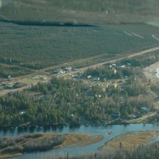
Hay River Protected Area, protected area in British Columbia, Canada
Ort: Northern Rockies Regional Municipality
GPS Koordinaten: 58.68694,-120.31528
Neueste Aktualisierung: 25. November 2023 um 00:42
Sambaa K’e
202.3 km
Chinchaga Wildland Provincial Park
178.8 km
Andy Bailey Provincial Park
127.6 km
Buckinghorse River Wayside Provincial Park
207.5 km
Jackpine Remnant Protected Area
178.6 km
Hay-Zama Lakes Wildland Provincial Park
75.8 km
Prophet River Wayside Provincial Park
165 km
Sikanni Old Growth Provincial Park
95.5 km
Kotcho Lake Village Provincial Park
57.9 km
Milligan Hills Provincial Park
133 km
Kotcho Lake Ecological Reserve
62.2 km
Sikanni Chief Canyon Provincial Park
171 km
Parker Lake Ecological Reserve
150.4 km
Fort Nelson River Ecological Reserve
130.1 km
Goguka Creek Protected Area
139 km
Thinahtea North Protected Area
121.9 km
Ekwan Lake Protected Area
27.8 km
Klua Lakes Protected Area
134.1 km
Thinahtea South Protected Area
107.6 km
Kledo Creek Provincial Park
185.5 km
Mozzy the Mosquito
56.8 km
Aussichtspunkt
125.7 km
Centennial Spray Park
185.4 km
Turm, Aussichtsturm, Aussichtspunkt
111.5 km
Fox Haven Golf & Country Club
186.6 km
Aussichtspunkt
197.8 km
Wasserfall
200.8 km
Rainbow Lake Golf & Country Club
56.5 kmBewertungen
Diesen Ort besucht? Tippe auf die Sterne, um ihn zu bewerten und deine Erfahrung oder Fotos mit der Community zu teilen! Jetzt ausprobieren! Sie können jederzeit kündigen.
Entdecke verborgene Schätze auf jedem Abenteuer!
Von charmanten kleinen Cafés bis zu versteckten Aussichtspunkten – entfliehe dem Touristentrubel und finde Orte, die wirklich zu dir passen. Unsere App macht's dir leicht: Sprachsuche, clevere Filter, optimierte Routen und echte Geheimtipps von Reisenden weltweit. Jetzt runterladen und das Abenteuer mobil erleben!

Ein neuer Ansatz für touristische Entdeckungen❞
— Le Figaro
Alle Orte, die eine Entdeckung wert sind❞
— France Info
Ein maßgeschneiderter Ausflug mit nur wenigen Klicks❞
— 20 Minutes