Bibury, Dorf in den Cotswolds, Gloucestershire, England.
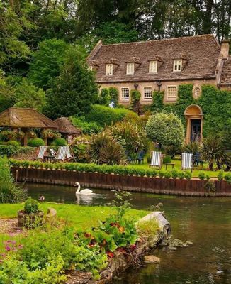
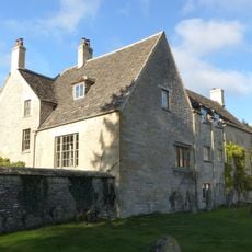
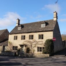
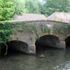
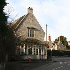
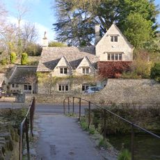
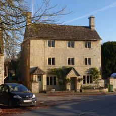
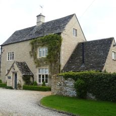
Bibury liegt entlang des Flusses Coln mit honigfarbenen Steinhäusern aus dem 17. Jahrhundert und Wasserwiesen, die eine pastorale Kulisse in der englischen Landschaft schaffen.
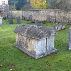
Das Dorf erscheint im Domesday Book von 1086 als Becheberie und wurde von klösterlichen Einrichtungen einschließlich des Priorats St. Maria Worcester bis zur Auflösung 1540 kontrolliert.
William Morris beschrieb Bibury als das schönste Dorf Englands, und es ist auf britischen Reisepässen als symbolisches Bild des ländlichen Britanniens erschienen.
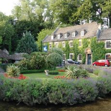
Besucher können im Swan Hotel oder Ferienhäusern übernachten, in der 1902 gegründeten Forellenfarm angeln und Wanderwege erkunden, die zu nahegelegenen Cotswold-Dörfern führen.
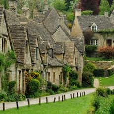
Arlington Row zeigt Häuser, die 1380 als klösterliche Wollspeicher gebaut und später zu Weberhäusern umgewandelt wurden, was sie zu einer der meistfotografierten Straßen Englands macht.
Ort: Cotswold
Adresse: Bibury, Cirencester GL7, UK
Website: http://bibury.com
GPS Koordinaten: 51.75800,-1.83200
Neueste Aktualisierung: 2. Oktober 2025 um 10:25
Arlington Row
201 m
Bibury Court
209 m
Ablington Manor
1.7 km
Church of St Mary
165 m
Winson Meadows
2.8 km
Church of St John the Baptist
3 km
The New Inn
3.3 km
Church House
150 m
House approximately 20 metres to north west of Church House
90 m
Bridge over River Coln approximately 20 metres north of Bibury Mill
352 m
William Skuce monument in the churchyard approximately 15 metres south of south aisle to Church of St Mary
182 m
Bridge Over River Coln Approximately 80 Meters West Of Ablington Manor
1.7 km
Swan Hotel
371 m
The Stores
3.2 km
Willson monument in the churchyard approximately 4 metres west of nave to Church of St Mary
139 m
Group of 2 monuments in the churchyard approximately 8 metres south west of porch to Church of St John the Baptist
3 km
Group of 6 monuments in the churchyard approximately 5 metres south of nave and west of porch to Church of St Mary
162 m
Group of 5 monuments in the churchyard approximately 6 metres south of chancel to Church of St John the Baptist
3 km
John Marchant monument in the churchyard approximately 20 metres south of chancel to Church of St Mary
191 m
Bridge House
127 m
John Hignell monument in the churchyard, approximately 4 metres south of porch to Church of St Mary
171 m
Group of 4 monuments in the churchyard approximately 15 metres south of tower to Church of St John the Baptist
3 km
Group of 9 monuments in the churchyard approximately 4 metres south of chancel to Church of St Mary
180 m
John Smith monument in the churchyard approximately 10 metres south east of chancel to Church of St John the Baptist
3 km
Richard Marchant monument in the churchyard approximately 7 metres south of south aisle to Church of St Mary
178 m
Post Office
3.2 km
Jasper Warren monument in the churchyard approximately 3 metres south of south aisle to Church of St Mary
173 m
Arlington Farmhouse
711 mDiesen Ort besucht? Tippe auf die Sterne, um ihn zu bewerten und deine Erfahrung oder Fotos mit der Community zu teilen! Jetzt ausprobieren! Sie können jederzeit kündigen.
Entdecke verborgene Schätze auf jedem Abenteuer!
Von charmanten kleinen Cafés bis zu versteckten Aussichtspunkten – entfliehe dem Touristentrubel und finde Orte, die wirklich zu dir passen. Unsere App macht's dir leicht: Sprachsuche, clevere Filter, optimierte Routen und echte Geheimtipps von Reisenden weltweit. Jetzt runterladen und das Abenteuer mobil erleben!
Ein neuer Ansatz für touristische Entdeckungen❞
— Le Figaro
Alle Orte, die eine Entdeckung wert sind❞
— France Info
Ein maßgeschneiderter Ausflug mit nur wenigen Klicks❞
— 20 Minutes