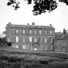
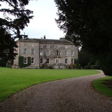
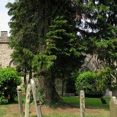
Cairn on Holgate How

Melden Sie sich bei Ihrem Konto an

AroundUs ist eine gemeinschaftlich erstellte Karte interessanter Orte, aufgebaut von neugierigen Entdecker:innen wie dir. Sie wächst mit jeder Bewertung, Geschichte und jedem Foto, das du teilst.
Melde dich an, um deine Lieblingsorte zu speichern, Orte hinzuzufügen und personalisierte Routen zu erstellen.
Wenn Sie fortfahren, akzeptieren Sie unsere Allgemeinen Geschäftsbedingungen und unsere Datenschutzrichtlinie

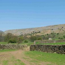
Cairn on Holgate How, cairn in New Forest, Richmondshire, England, UK

Ort: New Forest

GPS Koordinaten: 54.43800,-1.89739

Neueste Aktualisierung: 28. Oktober 2025 um 14:03
In der Nähe dieses Ortes
Gesamte Karte anzeigen
Fremington Edge
Vereinigtes Königreich

Fremington Edge

4.8 km
Barningham Park
Vereinigtes Königreich

Barningham Park

5.8 km
Marske Hall
Vereinigtes Königreich

Marske Hall

5.7 km
Church of St Edmund King and Martyr
Vereinigtes Königreich

Church of St Edmund King and Martyr

5.6 km
Monument On Adam Hill, South East Of Barningham Park
Vereinigtes Königreich

Monument On Adam Hill, South East Of Barningham Park

5.7 km
Rookby Memorial Approximately 20 Metres South Of Church Of St Edmund King And Martyr
Vereinigtes Königreich

Rookby Memorial Approximately 20 Metres South Of Church Of St Edmund King And Martyr

5.6 km
Carved rock and Romano-British settlement known as Greystone, 250m south of Moorcock Farm, Barningham Moor
Vereinigtes Königreich

Carved rock and Romano-British settlement known as Greystone, 250m south of Moorcock Farm, Barningham Moor

4.8 km
Cairn on the summit of Arndale Hill, Hope Moor
Vereinigtes Königreich

Cairn on the summit of Arndale Hill, Hope Moor

4.8 km
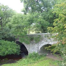
Pillimire Bridge
Vereinigtes Königreich

Pillimire Bridge

5.2 km
Cairn near the summit of a low ridge, 850m south west of Cocker Stake Nook, Hope Moor
Vereinigtes Königreich

Cairn near the summit of a low ridge, 850m south west of Cocker Stake Nook, Hope Moor

3.8 km
Cairn, 650m SSE of Bragg House, Barningham Moor
Vereinigtes Königreich

Cairn, 650m SSE of Bragg House, Barningham Moor

4.5 km
Cairn south of Cross Gill, 645m south east of Black Hill Gate, Barningham Moor
Vereinigtes Königreich

Cairn south of Cross Gill, 645m south east of Black Hill Gate, Barningham Moor

3.6 km
Cairn, 545m ESE of Bragg House, Barningham Moor
Vereinigtes Königreich

Cairn, 545m ESE of Bragg House, Barningham Moor

5 km
Cairnfield and associated remains, 250m south east of Bragg House, Barningham Moor
Vereinigtes Königreich

Cairnfield and associated remains, 250m south east of Bragg House, Barningham Moor

5 km
A carved rock within a large enclosure, 800m north east of Badger Way Stoop, Barningham Moor
Vereinigtes Königreich

A carved rock within a large enclosure, 800m north east of Badger Way Stoop, Barningham Moor

3.6 km
A carved rock and boulder walling, near the south wall of Scale Knoll Allotment, 500m north east of Black Hill Gate
Vereinigtes Königreich

A carved rock and boulder walling, near the south wall of Scale Knoll Allotment, 500m north east of Black Hill Gate

4.3 km
Carved rock 380m ENE of Bragg House, Barningham Moor
Vereinigtes Königreich

Carved rock 380m ENE of Bragg House, Barningham Moor

5.2 km
Carved rocks, cairnfield and rubble banks on the terrace south of Scale Knoll Allotment, immediately east of Black Hill Gate, Ba
Vereinigtes Königreich

Carved rocks, cairnfield and rubble banks on the terrace south of Scale Knoll Allotment, immediately east of Black Hill Gate, Ba

4 km
Cairn, 625m SSE of Bragg House, Barningham Moor
Vereinigtes Königreich

Cairn, 625m SSE of Bragg House, Barningham Moor

4.5 km
Carved rock and cairn in Rowley Intake, 410m south east of Cowclose House, Barningham Moor
Vereinigtes Königreich

Carved rock and cairn in Rowley Intake, 410m south east of Cowclose House, Barningham Moor

4.6 km
Prehistoric carved rocks and associated remains including cairns and a field system 800m south of Haythwaite, Barningham Moor
Vereinigtes Königreich

Prehistoric carved rocks and associated remains including cairns and a field system 800m south of Haythwaite, Barningham Moor

3.7 km
A carved rock between The Stang Forest boundary wall and Woodclose Gill, 750m south east of Far East Hope, Barningham Moor
Vereinigtes Königreich

A carved rock between The Stang Forest boundary wall and Woodclose Gill, 750m south east of Far East Hope, Barningham Moor

4.4 km
Prehistoric settlement and associated remains including carved rocks and a stone circle 400m north west of How Tallon Cairn, Bar
Vereinigtes Königreich

Prehistoric settlement and associated remains including carved rocks and a stone circle 400m north west of How Tallon Cairn, Bar

3.3 km
Cairnfield on a small knoll at Badger Way Stoop, Barningham Moor
Vereinigtes Königreich

Cairnfield on a small knoll at Badger Way Stoop, Barningham Moor

3 km
Carved rock north of Washbeck Green, 570m south of Haythwaite, Barningham Moor
Vereinigtes Königreich

Carved rock north of Washbeck Green, 570m south of Haythwaite, Barningham Moor

4 km
Carved rock and prehistoric enclosure on west side of Scale Knoll Gill, 410m south west of Haythwaite, Barningham Moor
Vereinigtes Königreich

Carved rock and prehistoric enclosure on west side of Scale Knoll Gill, 410m south west of Haythwaite, Barningham Moor

4.3 km
Cairnfield partly enclosed by a bank, on the east side of Woodclose Gill, Scale Knoll Allotment, Barningham Moor, 550m south of
Vereinigtes Königreich

Cairnfield partly enclosed by a bank, on the east side of Woodclose Gill, Scale Knoll Allotment, Barningham Moor, 550m south of

4.7 km
Monument And Adjacent Stone 300 Metres South-West Of Moor Gate
Vereinigtes Königreich

Monument And Adjacent Stone 300 Metres South-West Of Moor Gate

5.3 km
Gesamte Karte anzeigen

Bewertungen

Diesen Ort besucht? Tippe auf die Sterne, um ihn zu bewerten und deine Erfahrung oder Fotos mit der Community zu teilen! Jetzt ausprobieren! Sie können jederzeit kündigen.

« Cairn on Holgate How - cairn in New Forest, Richmondshire, England, UK » wird von Around Us (de.aroundus.com) bereitgestellt. Bilder und Texte stammen vom Wikimedia-Projekt unter einer Creative Commons-Lizenz. Sie dürfen Kopien dieser Seite unter den Bedingungen der Lizenz kopieren, verteilen und modifizieren, solange diese Notiz deutlich sichtbar ist.

Entdecke verborgene Schätze auf jedem Abenteuer!

Von charmanten kleinen Cafés bis zu versteckten Aussichtspunkten – entfliehe dem Touristentrubel und finde Orte, die wirklich zu dir passen. Unsere App macht's dir leicht: Sprachsuche, clevere Filter, optimierte Routen und echte Geheimtipps von Reisenden weltweit. Jetzt runterladen und das Abenteuer mobil erleben!

Around Us App Screenshot

Ein neuer Ansatz für touristische Entdeckungen

Le Figaro

Alle Orte, die eine Entdeckung wert sind

France Info

Ein maßgeschneiderter Ausflug mit nur wenigen Klicks

20 Minutes