
Teodoro R. Yangco historical marker
Teodoro R. Yangco historical marker, NHI historical marker for Teodoro R. Yangco
Ort: San Antonio
Gründung: 2005
Schöpfer: National Historical Commission of the Philippines
Adresse: T.R. Yangco Street
GPS Koordinaten: 14.94829,120.08965
Neueste Aktualisierung: 8. März 2025 um 23:05


Pinatubo
35.4 km
Natib
42.5 km
Fort Wint
24.8 km
Bataan-Nationalpark
45.9 km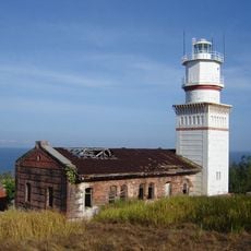
Capones Island lighthouse
9.4 km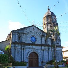
Santa Catalina de Alejandria Church
50.4 km
Casa Bizantina
50.4 km
Roosevelt Protected Landscape
23.3 km
Casa Hidalgo
50.3 km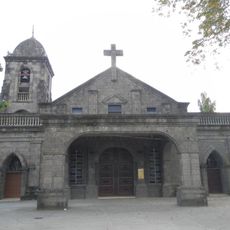
San Jose Obrero Church
47.1 km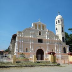
Saint Augustine Cathedral
43.7 km
Casa Unisan
50.4 km
Casa Jaen I
50.3 km
Pio Chapel
47.3 km
Subic Watershed Forest Reserve
30.3 km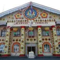
Zambales Provincial Capitol
43.6 km
Naval Base of Subic Bay historical marker
25.4 km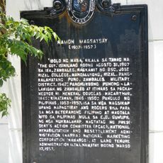
Ramon Magsaysay historical marker
43.9 km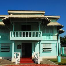
President Ramon Magsaysay House
11.5 km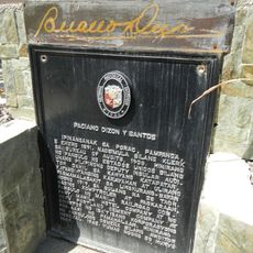
Paciano Dizon y Santos historical marker
50.5 km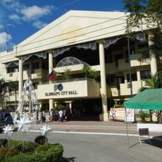
Olongapo City Hall
24.3 km
Resort
8.7 km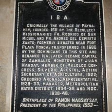
Iba historical marker
43.6 km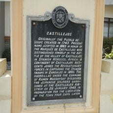
Castillejos historical marker
12 km
San Antonio Municipal Hall
42 m
Ambon-Ambon Falls
46.1 km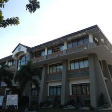
Castillejos Municipal Hall
12 km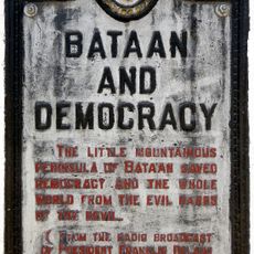
Bataan and Democracy historical marker
44.9 kmBewertungen
Diesen Ort besucht? Tippe auf die Sterne, um ihn zu bewerten und deine Erfahrung oder Fotos mit der Community zu teilen! Jetzt ausprobieren! Sie können jederzeit kündigen.
Entdecke verborgene Schätze auf jedem Abenteuer!
Von charmanten kleinen Cafés bis zu versteckten Aussichtspunkten – entfliehe dem Touristentrubel und finde Orte, die wirklich zu dir passen. Unsere App macht's dir leicht: Sprachsuche, clevere Filter, optimierte Routen und echte Geheimtipps von Reisenden weltweit. Jetzt runterladen und das Abenteuer mobil erleben!

Ein neuer Ansatz für touristische Entdeckungen❞
— Le Figaro
Alle Orte, die eine Entdeckung wert sind❞
— France Info
Ein maßgeschneiderter Ausflug mit nur wenigen Klicks❞
— 20 Minutes