
Boundary Stone, Circa 990 Metres North East Of Skelderskew Farmhouse
Boundary Stone, Circa 990 Metres North East Of Skelderskew Farmhouse, boundary marker in Commondale, Scarborough, North Yorkshire, UK
Ort: Commondale
Teil von: political border
GPS Koordinaten: 54.49845,-0.97438
Neueste Aktualisierung: 11. März 2025 um 13:08


Gisborough Moor
3.1 km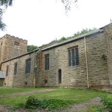
Church of St Michael And St George
4.6 km
Commondale War Memorial
1.5 km
Boundary Stone, Circa 475 Metres East Of Aysdalegate Farmhouse
3 km
Slapewath Viaduct
4.8 km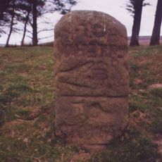
Guide Stone On North Side Of Road From Stokesley
1.7 km
Hob Cross Approximately 875 Metres To South Of Tidkinhow Farmhouse At Ngr Nz645 133
2.4 km
Commondale Shepherds' Memorial
1.8 km
Boundary Stone, Circa 600 Metres South East Of Aysdalegate Farmhouse
2.6 km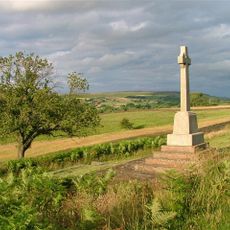
Castleton War Memorial, North Yorkshire
4.8 km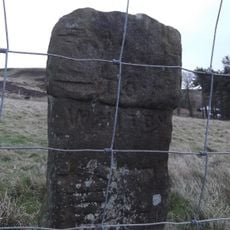
Guidestone 110 Yards North-East Of Birk Field Quarry
4.7 km
Boundary Stone Approximately 550 Metres South West Of Tidkinhow Farmhouse At Ngr Nz643 137
2.8 km
Ticksey How Boundary Stone 450 Metres South East Of Lockwood Beck Farmhouse
2.1 km
Boundary Stone, Circa 1,020 Metres North Of Skelderskew Farmhouse
269 m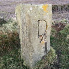
Boundary Stone, Circa 1,300 Metres North East Of Skelderskew Farmhouse
1.1 km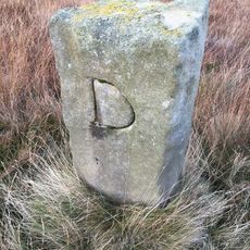
Boundary Stone, Circa 1450 Metres East Of Skelderskew Farmhouse
1.4 km
Milestone, nr Avons Farm
3.3 km
Boundary Stone, Circa 350 Metres South East Of Aysdalegate Farmhouse
2.8 km
Guibal Fanhouse At Skelton Shaft Iron Mine
5.7 km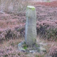
Job Cross, 925 Metres South West Of Dimmingdale Farmhouse
2.2 km
Guidepost Attached To Oven Close Bridge
2.2 km
Boundary Stone, Circa 1,150 Metres North East Of Skelderskew Farmhouse
561 m
Boundary Stone, Circa 1,400 Metres South Of Tidkinhow Farmhouse
1.9 km
Milestone, E of Gerrick Lane
4.4 km
8 Boundary Stones On Border With Westerdale Counry Parish
4.5 km
Milestone, Lockwood Beck
2.2 km
Milestone, Birk Brow Road (top)
3.1 km
Milestone, Birk Brow Road(bottom)
3.7 kmBewertungen
Diesen Ort besucht? Tippe auf die Sterne, um ihn zu bewerten und deine Erfahrung oder Fotos mit der Community zu teilen! Jetzt ausprobieren! Sie können jederzeit kündigen.
Entdecke verborgene Schätze auf jedem Abenteuer!
Von charmanten kleinen Cafés bis zu versteckten Aussichtspunkten – entfliehe dem Touristentrubel und finde Orte, die wirklich zu dir passen. Unsere App macht's dir leicht: Sprachsuche, clevere Filter, optimierte Routen und echte Geheimtipps von Reisenden weltweit. Jetzt runterladen und das Abenteuer mobil erleben!

Ein neuer Ansatz für touristische Entdeckungen❞
— Le Figaro
Alle Orte, die eine Entdeckung wert sind❞
— France Info
Ein maßgeschneiderter Ausflug mit nur wenigen Klicks❞
— 20 Minutes