Former Gner Engine Shed, architectural structure in Darlington, County Durham, UK
Ort: Darlington
GPS Koordinaten: 54.53187,-1.54303
Neueste Aktualisierung: 17. November 2025 um 08:50
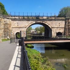
Skerne Bridge
570 m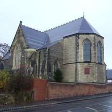
Church of St James
305 m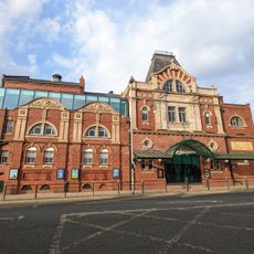
Darlington Hippodrome
884 m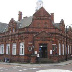
Darlington Library
880 m
3-7, Crown Street
872 m
North Lodge (Education Offices)
728 m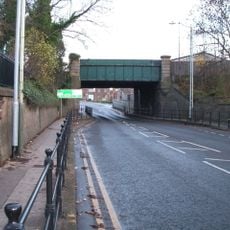
Bridge over North Road, Darlington
734 m
Bandstand To West Of Bowling Green
829 m
1 and 2, Mcnay Street
772 m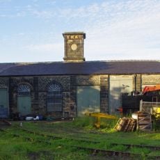
Goods Shed East South East Of North Road Station
764 m
Allan Street, next to St James church
289 m
Cleveland Street, opp. York Street
367 m
138-148 Northgate
716 m
Bridge Over The River Skerne
674 m
Forecourt Railings And Gate Piers To Northgate United Reformed Church
655 m
Front Garden Wall To North Lodge
701 m
Northgate United Reformed Church
642 m
Church of St Hilda
880 m
Numbers 31 To 35 (Odd) (Including Plain Wrought Iron Railings)
709 m
37 And 39, Russell Street
700 m
Bridge Over River Skerne
521 m
Odeon Darlington
619 m
Central School (East Block)
742 m
Central School Annexe
681 m
The former Throstle Nest Bridge, now the Arnold Road Subway
418 m
Route of the Stockton & Darlington Railway trackside sign
47 m
Roman Catholic School-Church of St William of York and St Francis de Sales
457 m
Locomotion
42 mBewertungen
Diesen Ort besucht? Tippe auf die Sterne, um ihn zu bewerten und deine Erfahrung oder Fotos mit der Community zu teilen! Jetzt ausprobieren! Sie können jederzeit kündigen.
Entdecke verborgene Schätze auf jedem Abenteuer!
Von charmanten kleinen Cafés bis zu versteckten Aussichtspunkten – entfliehe dem Touristentrubel und finde Orte, die wirklich zu dir passen. Unsere App macht's dir leicht: Sprachsuche, clevere Filter, optimierte Routen und echte Geheimtipps von Reisenden weltweit. Jetzt runterladen und das Abenteuer mobil erleben!

Ein neuer Ansatz für touristische Entdeckungen❞
— Le Figaro
Alle Orte, die eine Entdeckung wert sind❞
— France Info
Ein maßgeschneiderter Ausflug mit nur wenigen Klicks❞
— 20 Minutes