
Trees, building in Woolsington, Newcastle upon Tyne, Tyne and Wear, UK
Ort: Woolsington
GPS Koordinaten: 55.02739,-1.69492
Neueste Aktualisierung: 7. November 2025 um 08:44
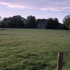
Woolsington Hall
644 m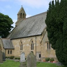
Church of St Matthew
3.1 km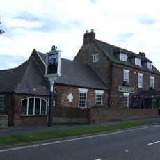
The Badger Inn
2.4 km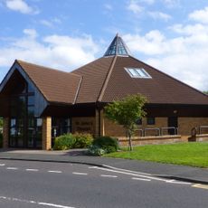
Church of St John the Evangelist
2.4 km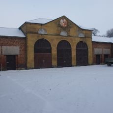
Stables And Coachhouse, North Of Woolsington Hall
651 m
Bullock Steads Farmhouse
1.3 km
Garden Walls South And East Of Prestwick Hall
2.5 km
House, South East Of Bullock Steads Farmhouse, And Farm Buildings Attached
1.4 km
Whorlton Grange
2.4 km
Prestwick Hall
2.6 km
Former School
3.1 km
Piers, Walls And Railings, East Of Church Of St Matthew And Former School
3.2 km
Gas Lamps At Entrance To South Drive
914 m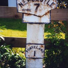
Milepost, Ponteland Road, by parking lane before Elm Road jct
2.7 km
Havannah Nature Reserve
3 km
Aussichtspunkt
2.3 km
East Wing Of Woolsington Hall
602 m
Orangery, East Of Woolsington Hall
623 m
Gate Piers And Walls At Entrance To South Drive
914 m
Orion Cinema
3 km
Westerhope Golf Club
2.3 km
Red House Farmhouse
3.1 km
Bath House Approximately 20 Yards South-East Of Prestwick Hall
2.6 km
Step Pyramid
3.2 km
Small step pyramid
3.1 km
Skulptur, Kunstwerk
2.5 km
Coal workings at Dewley Pits, 650m south west of Black Callerton
3.1 km
Aussichtspunkt
1.5 kmBewertungen
Diesen Ort besucht? Tippe auf die Sterne, um ihn zu bewerten und deine Erfahrung oder Fotos mit der Community zu teilen! Jetzt ausprobieren! Sie können jederzeit kündigen.
Entdecke verborgene Schätze auf jedem Abenteuer!
Von charmanten kleinen Cafés bis zu versteckten Aussichtspunkten – entfliehe dem Touristentrubel und finde Orte, die wirklich zu dir passen. Unsere App macht's dir leicht: Sprachsuche, clevere Filter, optimierte Routen und echte Geheimtipps von Reisenden weltweit. Jetzt runterladen und das Abenteuer mobil erleben!

Ein neuer Ansatz für touristische Entdeckungen❞
— Le Figaro
Alle Orte, die eine Entdeckung wert sind❞
— France Info
Ein maßgeschneiderter Ausflug mit nur wenigen Klicks❞
— 20 Minutes