Springs, building in Barlavington, Chichester, West Sussex, UK
Ort: Barlavington
GPS Koordinaten: 50.93597,-0.62265
Neueste Aktualisierung: 20. November 2025 um 23:01
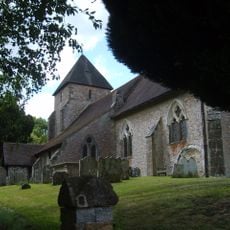
The Parish Church of St John the Baptist
1.1 km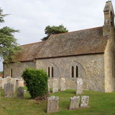
The Parish Church of St Mary
341 m
Rose Cottage
187 m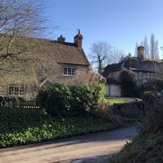
Bakers Cottage
1.2 km
Rock Cottage
1.2 km
Romano-British settlement at Church Farm
981 m
Barn At Barlavington Farm To The South East Of The Church
387 m
Haslands Farmhouse
479 m
Old School House
1.2 km
Bowl barrow on Barlavington Down
771 m
The Old Rectory
1.1 km
The Former Stable At Duncton Mill To The South Of The Mill Building
686 m
63 And 64, High Street
1.2 km
The Former Cart Shed And Granary At Duncton Mill To The North East Of The Mill House
749 m
Manor Farmhouse
1.1 km
Duncton Cottage
1.2 km
Duncton House
1.2 km
60, High Street
1.2 km
Duncton Mill, The Mill House
751 m
South Corner
1.1 km
Rectory Gate Cottage
1.2 km
The Old Manor
1.2 km
Folly Cottage
538 m
Barn At Duncton Mill To The North East Of The Former Cart Shed And Granary
745 m
Prehistoric linear boundary on Barlavington Down, 550m north east of Dog Kennels
1 km
The Hollows
1.2 km
Duncton Mill, The Mill Building
708 m
Barn At Manor Farm To The North West Of The Manor House
1.1 kmBewertungen
Diesen Ort besucht? Tippe auf die Sterne, um ihn zu bewerten und deine Erfahrung oder Fotos mit der Community zu teilen! Jetzt ausprobieren! Sie können jederzeit kündigen.
Entdecke verborgene Schätze auf jedem Abenteuer!
Von charmanten kleinen Cafés bis zu versteckten Aussichtspunkten – entfliehe dem Touristentrubel und finde Orte, die wirklich zu dir passen. Unsere App macht's dir leicht: Sprachsuche, clevere Filter, optimierte Routen und echte Geheimtipps von Reisenden weltweit. Jetzt runterladen und das Abenteuer mobil erleben!

Ein neuer Ansatz für touristische Entdeckungen❞
— Le Figaro
Alle Orte, die eine Entdeckung wert sind❞
— France Info
Ein maßgeschneiderter Ausflug mit nur wenigen Klicks❞
— 20 Minutes