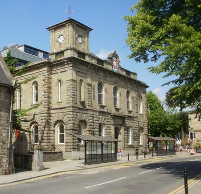
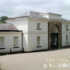
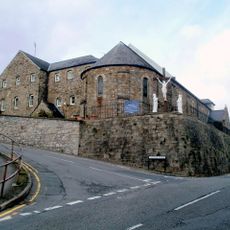
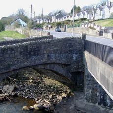
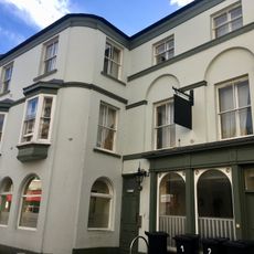
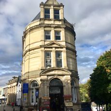
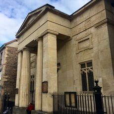
Town Hall, Grade II listed building in Torfaen County Borough. In the centre of Pontypool at the junction of Hanbury Road and Glentorvaen Road
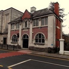
Das Rathaus von Pontymoile ist ein Gebäude aus Stein mit italienischem Baustil aus der Mitte des 19. Jahrhunderts, das 1856 eröffnet wurde. Das Gebäude hat eine unregelmäßige Fassade mit fünf Abschnitten, wobei die linke Seite leicht vorragt und einen kleinen Uhrenturm trägt, während die rechte Seite zurückgesetzt ist.
Das Gebäude wurde 1854 gegründet als Geschenk von Lord Lieutenant Capel Hanbury Leigh zur Geburt seines Sohnes und 1856 mit einem festlichen Konzert eröffnet. Im Laufe des 20. Jahrhunderts entwickelte sich der Bau zum Verwaltungszentrum der Stadt und wurde später Teil eines größeren Verwaltungskomplexes.
Das Rathaus war lange Zeit ein Treffpunkt für Bürger, um sich bei wichtigen Fragen auszutauschen und gemeinsame Anlässe zu feiern. Sein Standort im Zentrum von Pontymoile machte es zu einem Symbol für das Gemeinschaftsleben der Stadt.
Das Gebäude ist über Hanbury Road leicht zu erreichen und verfügt über einen geschützten Status, der seine historischen Merkmale bewahrt hat. Besucher sollten beachten, dass es sich um ein funktionierendes Verwaltungszentrum handelt, daher sind die Öffnungszeiten begrenzt.
Der Grundstein wurde 1854 von Mrs. Hanbury Leigh gelegt, und die Eröffnungsfeier war ein elegantes Abendkonzert statt einer typischen Zeremonie. Dieses Ereignis war bedeutsam, da es für Pontymoile das erste Mal war, einen dedizierten öffentlichen Treffpunkt zu haben.
Die Community neugieriger Reisender
AroundUs vereint tausende ausgewählte Orte, lokale Tipps und versteckte Schätze, täglich bereichert von über 60,000 Mitwirkenden weltweit.