Aboriginal bark-stripped tree
Ort: Walcha
Ort: Walcha Council
GPS Koordinaten: -30.96701,152.01001
Neueste Aktualisierung: 21. November 2025 um 12:59
Oxley Wild Rivers National Park
15.2 km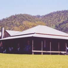
Kunderang East Pastoral Station
15.9 km
Apsley Gorge National Park
17.9 km
Yarrowitch Gorge National Park
22.1 km
Aussichtspunkt
16.2 km
Chasm Lookout
24.6 km
Probable site of old hut
23.9 km
Aussichtspunkt
19.8 km
Budds Mare Lookout
4.2 km
Oxley Lookout
24.6 km
Aussichtspunkt
2.4 km
The Rocks
12.9 km
Aussichtspunkt
20.6 km
Aussichtspunkt
10.1 km
Aboriginal Coolamon tree
539 m
Old cattle yards
2.6 km
Marys View
20.3 km
Tiara Lookout
24.7 km
Aussichtspunkt
19.9 km
Remains of hearth
14.9 km
Cattle yards (1890's)
591 m
Old water well
5.6 km
Possible site of old hut
5.6 km
Old cattle yards (corner post)
9.2 km
Old cattle yards (corner post)
9.3 km
Colwells Yards
20 km
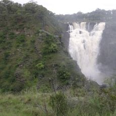
Moona Falls
10.2 km
Steep Drop Falls
14.2 kmBewertungen
Diesen Ort besucht? Tippe auf die Sterne, um ihn zu bewerten und deine Erfahrung oder Fotos mit der Community zu teilen! Jetzt ausprobieren! Sie können jederzeit kündigen.
Entdecke verborgene Schätze auf jedem Abenteuer!
Von charmanten kleinen Cafés bis zu versteckten Aussichtspunkten – entfliehe dem Touristentrubel und finde Orte, die wirklich zu dir passen. Unsere App macht's dir leicht: Sprachsuche, clevere Filter, optimierte Routen und echte Geheimtipps von Reisenden weltweit. Jetzt runterladen und das Abenteuer mobil erleben!

Ein neuer Ansatz für touristische Entdeckungen❞
— Le Figaro
Alle Orte, die eine Entdeckung wert sind❞
— France Info
Ein maßgeschneiderter Ausflug mit nur wenigen Klicks❞
— 20 Minutes