Rosewall Creek Provincial Park, provincial park in British Columbia, Canada
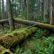
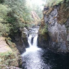
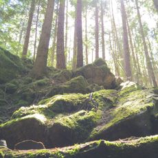
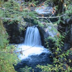
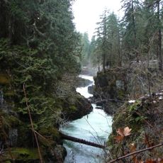
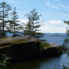
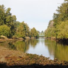
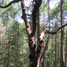
Rosewall Creek Provincial Park ist ein kleiner Park entlang eines Baches in der Region Nanaimo mit Wanderwegen durch Wald und eine kleine Wasserfallkaskade, die dem Ort einen ruhigen Klang verleiht. Das Gebiet wird von großen Ahornbäumen und Nadelbäumen geprägt und verfügt über einfache Rastplätze mit Picknicktischen auf beiden Seiten des Baches.
Der Park wurde 1956 gegründet, um Leutnant Ian MacDonald zu ehren, einen kanadischen Soldaten, der während der Normandie-Invasion 1944 fiel. Die Schaffung des Parks war das Ergebnis von Bemühungen der lokalen Gemeinde, sein Andenken zu bewahren und die Waldlandschaft der Region zu schützen.
Der Park ist ein Ort, an dem die lokale Geschichte lebendig wird und die Verbindung der Gemeinde zur Natur sichtbar ist. Besucher können hier die großen Ahornbäume beobachten, deren Blätter sich im Herbst verfärben, und dem Plätschern des Baches lauschen, während sie die einfache, ruhige Art verstehen, wie Menschen diesen Ort nutzen.
Das Gelände ist etwa 3 Kilometer südlich von Fanny Bay leicht zugänglich und kann über die Cook Creek-Ausfahrt der Highway 19 oder 19A erreicht werden. Besucher sollten wissen, dass Wanderpfade nach schweren Regenfällen oder Schneeschmelze wegen steigender Wasserstände geschlossen sein können und es ratsam ist, vor dem Besuch aktuelle Bedingungen zu überprüfen.
Der Park ist besonders bedeutsam für die Koho-Lachswanderung, bei der Fische im Oktober stromaufwärts schwimmen, um zu laichen, was Besucher beobachten können. Dieser natürliche Prozess macht den Herbst zu einer besonderen Zeit, um die Vitalität der lokalen Gewässer und ihre Rolle für die Tierwelt zu erleben.
Die Community neugieriger Reisender
AroundUs vereint tausende ausgewählte Orte, lokale Tipps und versteckte Schätze, täglich bereichert von über 60,000 Mitwirkenden weltweit.