
San Fernando, Gemeinde in der philippinischen Provinz Masbate
Ort: Masbate
Höhe über dem Meer: 36 m
Grenzt an: Masbate City
Website: http://sanfernando-masbate.gov.ph
GPS Koordinaten: 12.48583,123.76278
Neueste Aktualisierung: 13. März 2025 um 03:47
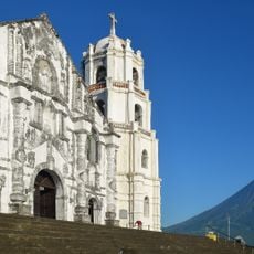
Daraga Church
74.1 km
Capul Church
46.1 km
Bulusan Volcano National Park
44.4 km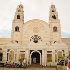
Sorsogon Cathedral
59.8 km
Capul Island Lighthouse
41.2 km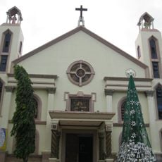
Masbate Cathedral
20.3 km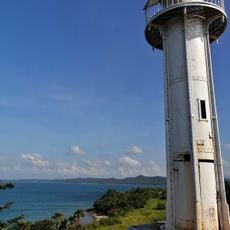
Bagatao Island Lighthouse
38.7 km
Magasang Rock Formation
69.8 km
The Forts of Bulusan historical marker
50.3 km
Church of Capul historical marker
46.1 km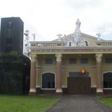
Bacon Church
68.5 km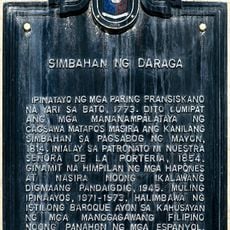
Church of Daraga historical marker
74.1 km
Bituon Beach Resort
21.3 km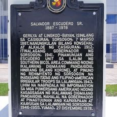
Salvador Escudero Sr. historical marker
60.2 km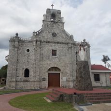
Barcelona Church
59.2 km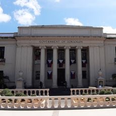
Sorsogon Provincial Capitol
60 km
La Edley
74.5 km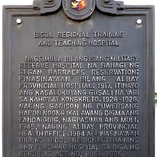
Bicol Regional Training and Teaching Hospital historical marker
73.7 km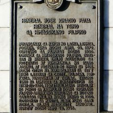
General Jose Ignacio Paua historical marker
73 km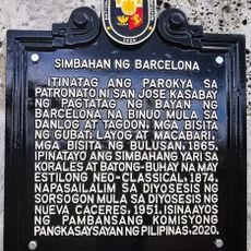
Church of Barcelona historical marker
59.3 km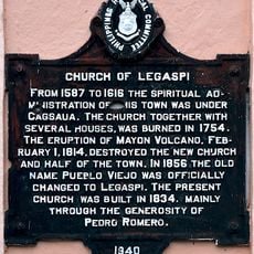
Church of Legaspi historical marker
73.8 km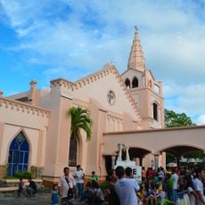
Legazpi Church
73.8 km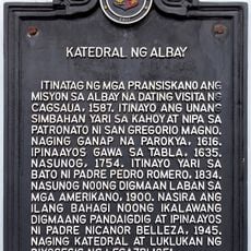
Cathedral of Albay historical marker
72.7 km
Capul Lighthouse historical marker
41.1 km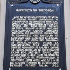
Capitol of Sorsogon historical marker
60 km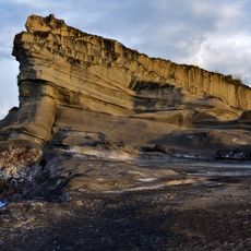
Magsapad Rock Formation
70 km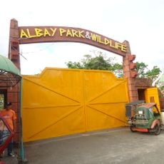
Albay Park and Wildlife
74.8 km
Caranas Rock Formation
71.1 kmBewertungen
Diesen Ort besucht? Tippe auf die Sterne, um ihn zu bewerten und deine Erfahrung oder Fotos mit der Community zu teilen! Jetzt ausprobieren! Sie können jederzeit kündigen.
Entdecke verborgene Schätze auf jedem Abenteuer!
Von charmanten kleinen Cafés bis zu versteckten Aussichtspunkten – entfliehe dem Touristentrubel und finde Orte, die wirklich zu dir passen. Unsere App macht's dir leicht: Sprachsuche, clevere Filter, optimierte Routen und echte Geheimtipps von Reisenden weltweit. Jetzt runterladen und das Abenteuer mobil erleben!

Ein neuer Ansatz für touristische Entdeckungen❞
— Le Figaro
Alle Orte, die eine Entdeckung wert sind❞
— France Info
Ein maßgeschneiderter Ausflug mit nur wenigen Klicks❞
— 20 Minutes