
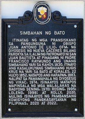
Church of Bato historical marker
Church of Bato historical marker, NHCP historical marker for Bato Church
Ort: Bato
Gründung: 17. Mai 2022
Schöpfer: National Historical Commission of the Philippines
GPS Koordinaten: 13.61001,124.29698
Neueste Aktualisierung: 11. März 2025 um 11:02

Mayon
77.1 km
Cagsawa Ruins
81.3 km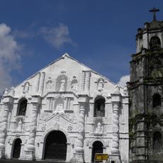
Daraga Church
81.5 km
Mayon Volcano Natural Park
77.1 km
Masaraga
82.5 km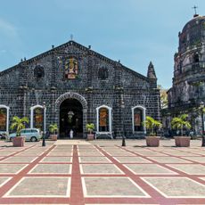
Tabaco Church
67.5 km
Sorsogon Cathedral
78.1 km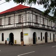
Smith, Bell and Company House
67.2 km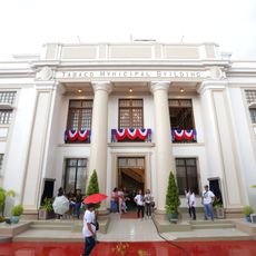
Tabaco City Hall
67.3 km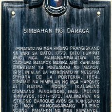
Church of Daraga historical marker
81.4 km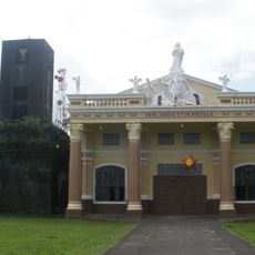
Bacon Church
69.5 km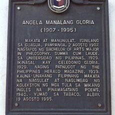
Angela Manalang Gloria historical marker
67.2 km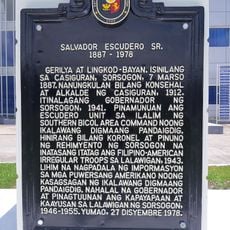
Salvador Escudero Sr. historical marker
77.7 km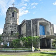
Virac Cathedral
7.9 km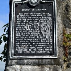
Church of Cagsaua historical marker
81.3 km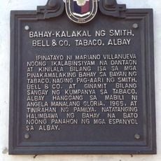
Commercial Building of Smith, Bell & Co. Tabaco, Albay historical marker
67.2 km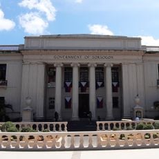
Sorsogon Provincial Capitol
77.9 km
La Edley
79.4 km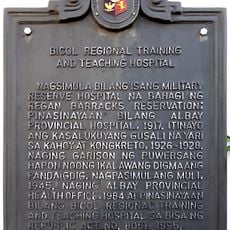
Bicol Regional Training and Teaching Hospital historical marker
80.6 km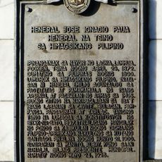
General Jose Ignacio Paua historical marker
80.6 km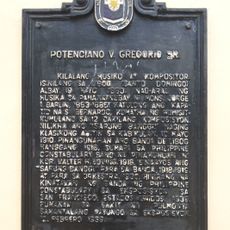
Potenciano V. Gregorio Sr. historical marker
70 km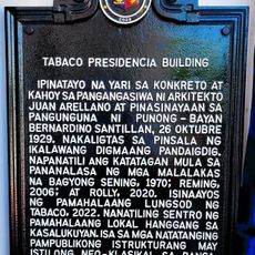
Tabaco Presidencia Building historical marker
67.4 km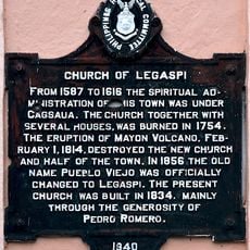
Church of Legaspi historical marker
78.1 km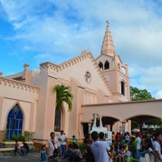
Legazpi Church
78 km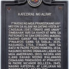
Cathedral of Albay historical marker
80.5 km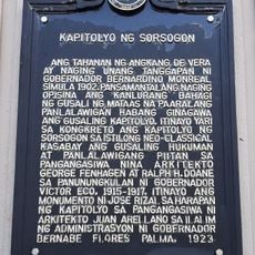
Capitol of Sorsogon historical marker
77.9 km
Albay Park and Wildlife
79.5 km
St. Agnes Academy historical marker
79.8 kmDiesen Ort besucht? Tippe auf die Sterne, um ihn zu bewerten und deine Erfahrung oder Fotos mit der Community zu teilen! Jetzt ausprobieren! Sie können jederzeit kündigen.
Entdecke verborgene Schätze auf jedem Abenteuer!
Von charmanten kleinen Cafés bis zu versteckten Aussichtspunkten – entfliehe dem Touristentrubel und finde Orte, die wirklich zu dir passen. Unsere App macht's dir leicht: Sprachsuche, clevere Filter, optimierte Routen und echte Geheimtipps von Reisenden weltweit. Jetzt runterladen und das Abenteuer mobil erleben!

Ein neuer Ansatz für touristische Entdeckungen❞
— Le Figaro
Alle Orte, die eine Entdeckung wert sind❞
— France Info
Ein maßgeschneiderter Ausflug mit nur wenigen Klicks❞
— 20 Minutes