
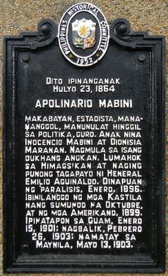
Apolinario Mabini historical marker
Apolinario Mabini historical marker, PHC historical marker for Apolinario Mabini in Tanauan
Ort: Tanauan
Gründung: 1952
Schöpfer: National Historical Commission of the Philippines
GPS Koordinaten: 14.10090,121.09921
Neueste Aktualisierung: 8. März 2025 um 00:16

Taal
14.9 km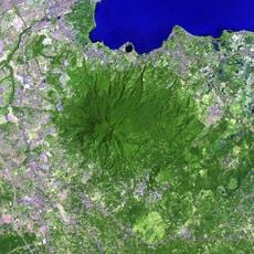
Makiling
11.4 km
Rizal Shrine
14.5 km
People's Park in the Sky
9.5 km
Mount Sungay
9.5 km
Calamba Claypot
14.6 km
Matang Tubig
12.1 km
UPLB Museum of Natural History
16 km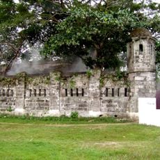
Cuartel de Santo Domingo
15.4 km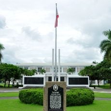
Apolinario Mabini Shrine
35 m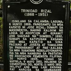
Trinidad Rizal historical marker
16.2 km
Tagaytay Ridge Landing historical marker
14.9 km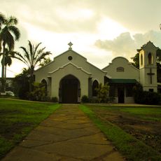
Church Among the Palms
16.7 km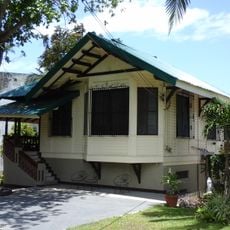
General Paciano Rizal Shrine
16.2 km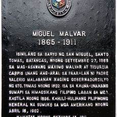
Miguel Malvar historical marker
4.8 km
Dona Salud Resort
12.7 km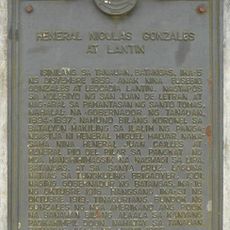
General Nicolas Gonzales y Lantin historical marker
9.6 km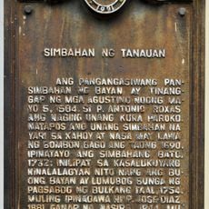
Church of Tanauan historical marker
6.1 km
Banio kreek
15.1 km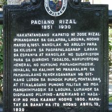
Paciano Rizal historical marker
16.2 km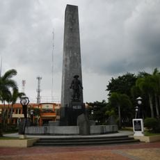
Malvar Shrine
4.8 km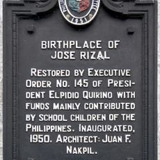
Birthplace of Jose Rizal historical marker
14.5 km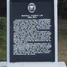
General Vicente Lim historical marker
14.5 km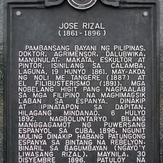
Jose Rizal historical marker
12.4 km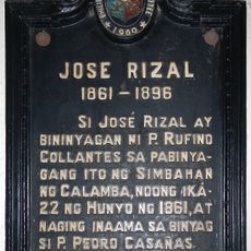
Jose Rizal historical marker
14.6 km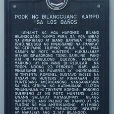
Site of the Internment Camp at Los Baños historical marker
16.9 km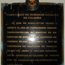
Baptistry of the Catholic Church of Calamba historical marker
14.6 km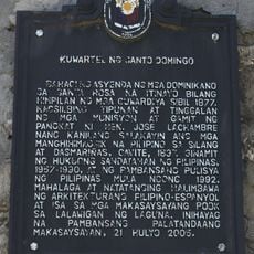
Barracks of Santo Domingo historical marker
15.4 kmBewertungen
Diesen Ort besucht? Tippe auf die Sterne, um ihn zu bewerten und deine Erfahrung oder Fotos mit der Community zu teilen! Jetzt ausprobieren! Sie können jederzeit kündigen.
Entdecke verborgene Schätze auf jedem Abenteuer!
Von charmanten kleinen Cafés bis zu versteckten Aussichtspunkten – entfliehe dem Touristentrubel und finde Orte, die wirklich zu dir passen. Unsere App macht's dir leicht: Sprachsuche, clevere Filter, optimierte Routen und echte Geheimtipps von Reisenden weltweit. Jetzt runterladen und das Abenteuer mobil erleben!

Ein neuer Ansatz für touristische Entdeckungen❞
— Le Figaro
Alle Orte, die eine Entdeckung wert sind❞
— France Info
Ein maßgeschneiderter Ausflug mit nur wenigen Klicks❞
— 20 Minutes