
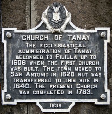
Church of Tanay historical marker
Church of Tanay historical marker, NHCP historical marker for Tanay Church
Ort: Tanay
Gründung: 1939
Schöpfer: National Historical Commission of the Philippines
Adresse: M. H. del Pilar Street
GPS Koordinaten: 14.49850,121.28478
Neueste Aktualisierung: 8. März 2025 um 00:16
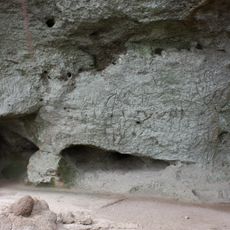
Petroglyphen auf den Philippinen
11.2 km
Antipolo Cathedral
15.3 km
Hinulugang Taktak National Park
16.6 km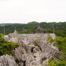
Masungi Georeserve
13.2 km
Manggahan Floodway
16.3 km
Mount Sembrano
15.4 km
Santuario de San Jose
15.7 km
Morong Church
3.3 km
Bosay Resort
15.3 km
Morong High School
5.9 km
Church of Old Bosoboso historical marker
16.5 km
Blanco Family Museum
14.9 km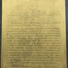
Juan M. Sumulong historical marker
15.4 km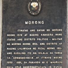
Morong historical marker
5.2 km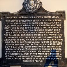
Our Lady of Peace and Good Voyage historical marker
15.3 km
Casa Santa Museum
15.6 km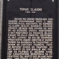
Tomas Claudio historical marker
5.2 km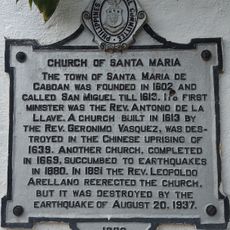
Church of Santa Maria historical marker
15.3 km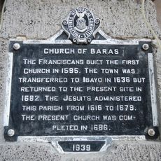
Church of Baras historical marker
3.3 km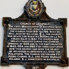
Church of Antipolo historical marker
15.3 km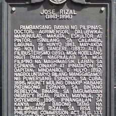
Jose Rizal historical marker
15.9 km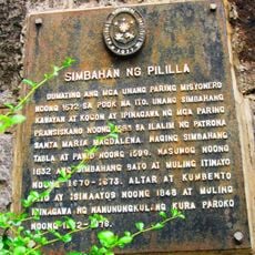
Pililla Church historical marker
3.1 km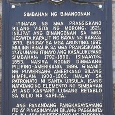
Church of Binangonan historical marker
10.6 km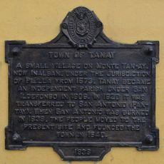
Town of Tanay historical marker
52 m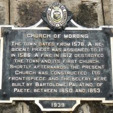
Church of Morong historical marker
5.4 km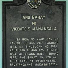
Vicente Manasala House historical marker
12.8 km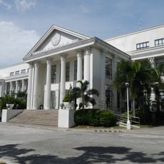
Rizal Provincial Capitol
15.8 km
Commandancia
5.2 kmDiesen Ort besucht? Tippe auf die Sterne, um ihn zu bewerten und deine Erfahrung oder Fotos mit der Community zu teilen! Jetzt ausprobieren! Sie können jederzeit kündigen.
Entdecke verborgene Schätze auf jedem Abenteuer!
Von charmanten kleinen Cafés bis zu versteckten Aussichtspunkten – entfliehe dem Touristentrubel und finde Orte, die wirklich zu dir passen. Unsere App macht's dir leicht: Sprachsuche, clevere Filter, optimierte Routen und echte Geheimtipps von Reisenden weltweit. Jetzt runterladen und das Abenteuer mobil erleben!

Ein neuer Ansatz für touristische Entdeckungen❞
— Le Figaro
Alle Orte, die eine Entdeckung wert sind❞
— France Info
Ein maßgeschneiderter Ausflug mit nur wenigen Klicks❞
— 20 Minutes