El Naranjero Dam, stuwmeer in Valencia, Spanje
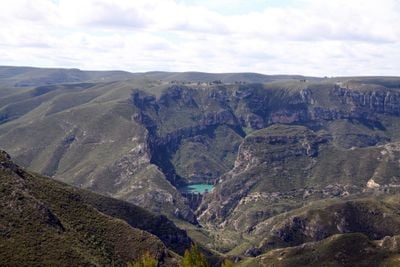
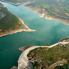
El Naranjero Dam ist ein Betonstaudamm mit Bogengravitärkonstruktion im Júcar-Fluss in der Provinz Valencia. Die Anlage staut Wasser über einer Fläche von etwa 125 Hektar auf und versorgt die umliegenden Gebiete mit Wasser für Landwirtschaft, Haushalte und Stromerzeugung.
Die Stauerrichtung began in den 1980er Jahren und nahm 1989 ihren Betrieb auf, als ein Meilenstein in der Wasserwirtschaft der Region. Das Bauwerk war ein wichtiges Infrastrukturprojekt, das die Wassersicherheit für Landwirtschaft und Haushalte in der Gegend erheblich verbesserte.
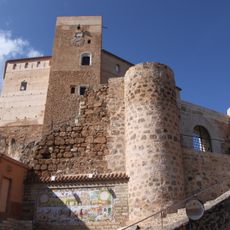
Der Staudamm ist ein Zeichen der Wasserbewirtschaftung in der Region, die für die örtliche Bevölkerung wichtig ist. Die Anlagen zeigen, wie Menschen und Natur in diesem Gebiet zusammenleben und wie Wasser täglich genutzt wird.
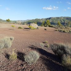
Der Ort ist offen für Besucher und eignet sich für Spaziergänge und Picknicks mit freiem Blick auf das Wasser und die umliegende Landschaft. Klare Tage bieten die beste Sicht auf die Staumauer und die Wasserfläche, daher ist es ratsam, zu solchen Zeiten zu besuchen.
Das Wasser aus dem Stausee fließt durch einen 13 Kilometer langen unterirdischen Tunnel zur Wasserkraftanlage in Millares, wo es 80 Megawatt Strom erzeugt. Dies zeigt, wie die Anlage nicht nur Wasser speichert, sondern auch bedeutende Mengen an Energie für die Region produziert.
Die Community neugieriger Reisender
AroundUs vereint tausende ausgewählte Orte, lokale Tipps und versteckte Schätze, täglich bereichert von über 60,000 Mitwirkenden weltweit.